Most detailed pictures of Earth ever seen
These spectacular images are the most detailed true colour pictures of the Earth that we have ever seen.The clear images, released by NASA, were pieced together from observations taken from a satellite of the land surface, oceans, sea ice and clouds.
Using a collection of these satellite-based observations, NASA scientists have stitched together months of observations of the earth's surface and combined them to create a colourful mosaic of our living planet.
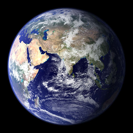
Spectacular: Most detailed image of Earth to date
The result from using these collection of images is a complete and detailed glimpse of every square kilometre of Earth.
Most of the information contained in these image came from a single remote-sensing device known as Moderate Resolution Imaging Spectroradiometer, or MODIS.
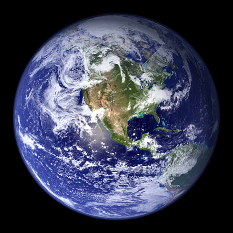
Clear: NASA images of North and South America were compiled over months
The device, which takes the images from 700 kilometres above the Earth, provides an integrated tool for scientists to observe and study a variety of earth life.
The images are based on observations, or pictures, collected over a period of roughly three months and were combined every eight days to ensure clouds were not blocking the sensor's view on any given day.
The Blue Marble images form part of NASA's Visable Earth catalogue which also provides pictures of earth by night as well as showing the extent of deforestation in Brazil from space.
Subscribe to:
Post Comments
(
Atom
)


No comments :
Post a Comment